
Jizo Toge-goe Course
●Difficulty: Advanced, suitable for strong walkers
●Walking Period: June to first snowfall* (Please inquire about trail status and conditions.)
●Total Length: Approximately 12 km (Kita-Otari Station → Fukahara-guchi → Kyo Shimizu → Bangoya-ato → Jizo Toge → Misaka Toge → Chojadaira)
●Time Required: About 7 hours from south to north / About 7 hours 5 minutes from north to south
Highlights
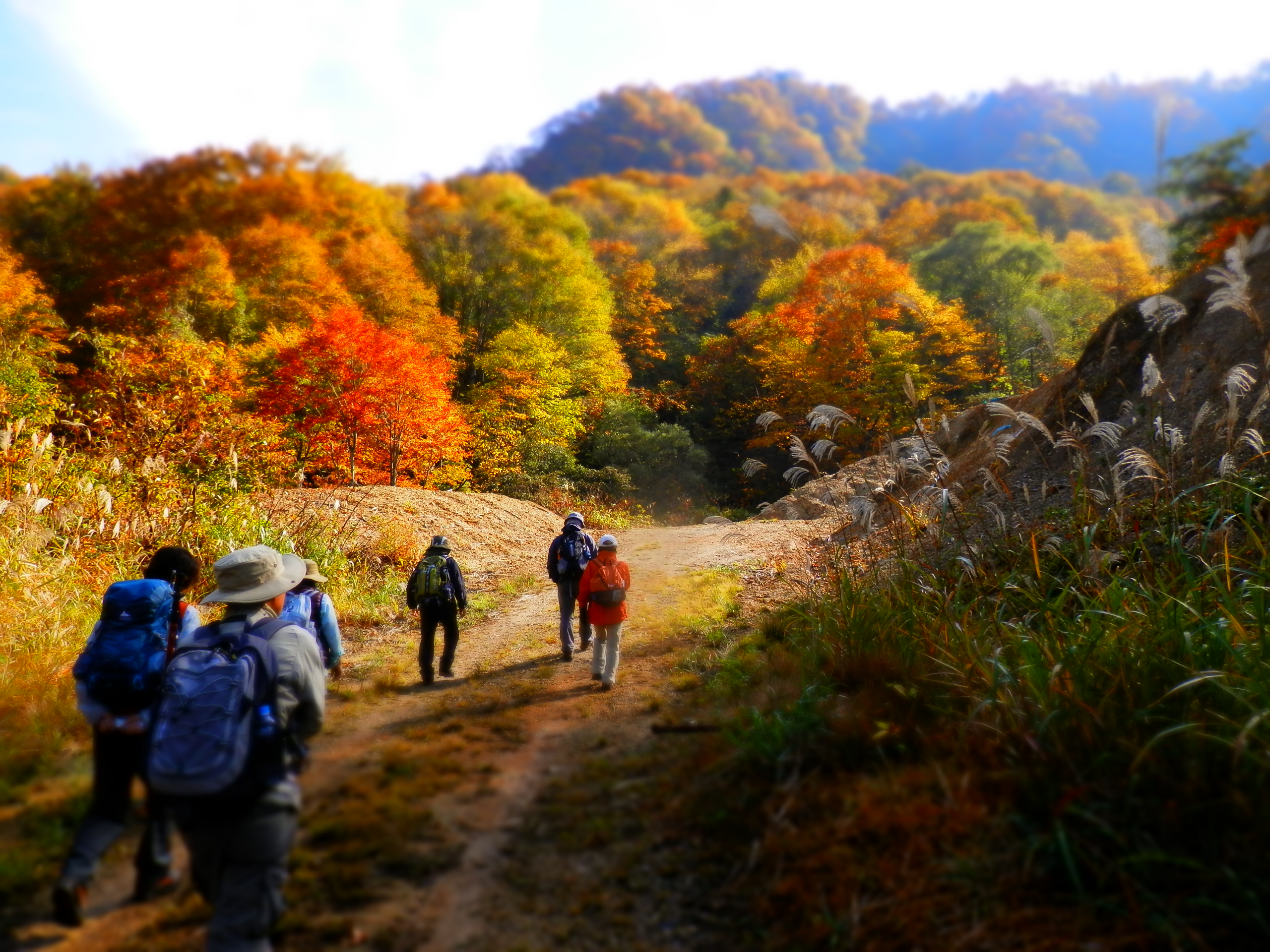
●Hike through a flourishing natural landscape on pleasant dirt trails that seldom see visitors
●Spy the wonderful sights from multiple scenic viewpoints high above the valley
●Experience the richness of the seasons through spring flowers, summer green, and fall foliage
●Wonder at the massive, twisted trees that line the path near the Jizo-Toge pass
Please see the Japanese page for the course map.
The Jizo Toge-goe Course takes you higher into the mountains and further off the beaten path than perhaps any other section of the Shionomichi. It is a physically demanding walk with no facilities or escape points for most of the way, but one that amply rewards visitors with spectacular scenery and a rich and layered historical narrative. The trail passes through secluded forests and valleys and up and over two mountain passes that are covered in snow for almost half the year. In ancient times it was used for the Jade and Obsidian trade and later as an official government road connecting outlying provinces with the 8th-century capital of Nara. It also played an essential role in the long, protracted battles between rival samurai warlords Uesugi Kenshin and Takeda Shingen.
Elevation Profile
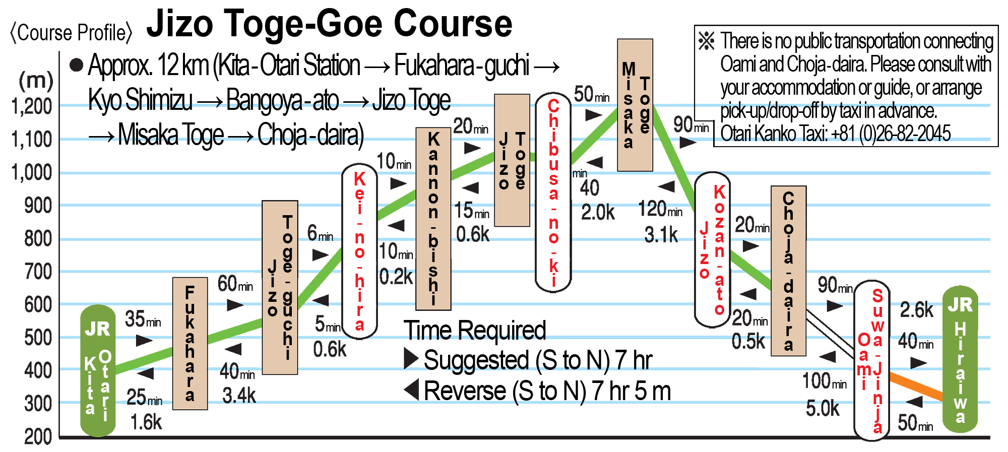
This course travels on steep terrain through a remote area, so please pack and plan accordingly, and be sure to give yourself ample time to finish the walk. Furthermore, because of the difficulty in arranging transportation to/from Chojadaira, one recommended option is to do an out-and-back walk from Kita-Otari Station to Misaka Toge.
Access
By Car
Parking is available at the southern end of the course using the parking lot for Kita-Otari Station. The parking lot for the Hiraiwa Ideyu-no-Hiroba can be used at the northern end of the walk, but keep in mind it’s approximately 3 kilometers / 50 minutes on foot to the Oami settlement, and another 5 kilometers / 100 minutes onward to Chojadaira.
By Train
Kita-Otari Station is the closest and most convenient station for accessing the Fukahara settlement at the southern end of the course. Alternatively, the settlement of Oami at the northern end of the course can be reached on foot from Hiraiwa Station in around 50 minutes. It’s another 100 minutes further to Chojadaira from Oami.
Historical Landmarks & Points of Interest
-
Fukahara Suwa-jinja
(Designated as an Important Cultural Asset by both Otari Village & Nagano Prefecture)
-
Ke-no-Hira
This location marks the spot where a conch shell was trumpeted by the front line of Uesugi Kenshin‘s forces to announce the arrival of reinforcements to aid in the 1557 battle for Hirakura Castle, which eventually fell to Takeda Shingen‘s invading army.
-
Jidanda
This scenic lookout is reportedly where Uesugi’s reinforcements, coming from Echigo, spotted flames rising from Hirakura Castle as it was overthrown. The name literally means “ground stamping,” and alludes to the fact that the men stomped their feet in frustration and anger as they realized they were too late.
-
Jizo-do
This small hall, perched at the 1,036-meter summit of Jizo pass, enshrines several images of Jizo Bosatsu, who oversees the safety of travelers on the Salt Road still today. The view from here is excellent, with a primeval beech forest stretching out in all directions and yuki tsubaki snow camellias blooming in beautiful red clusters from early to late May. 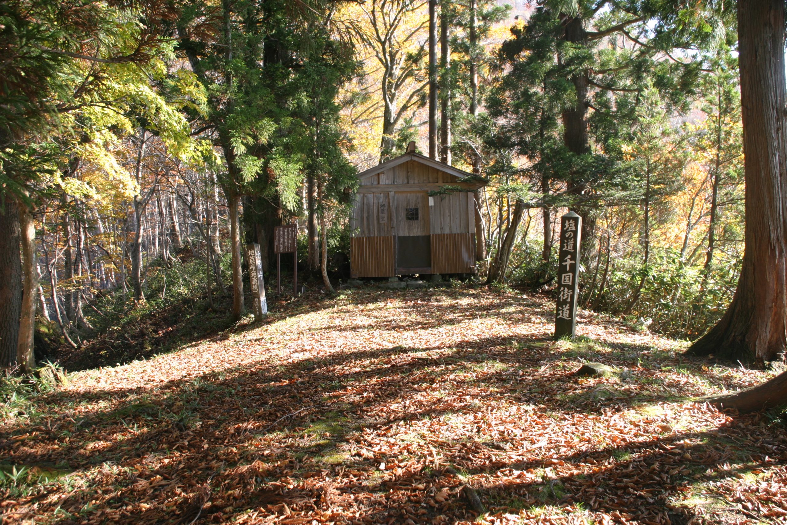
-
Nyubo-no-ki
This massive castor oil tree has long been revered as sacred. Two large lumps on its trunk were said to resemble breasts, and thought to offer divine power to ensure safe childbirth and fertility to those who prayed here. (Designated as an Important Cultural Asset by Otari Village) 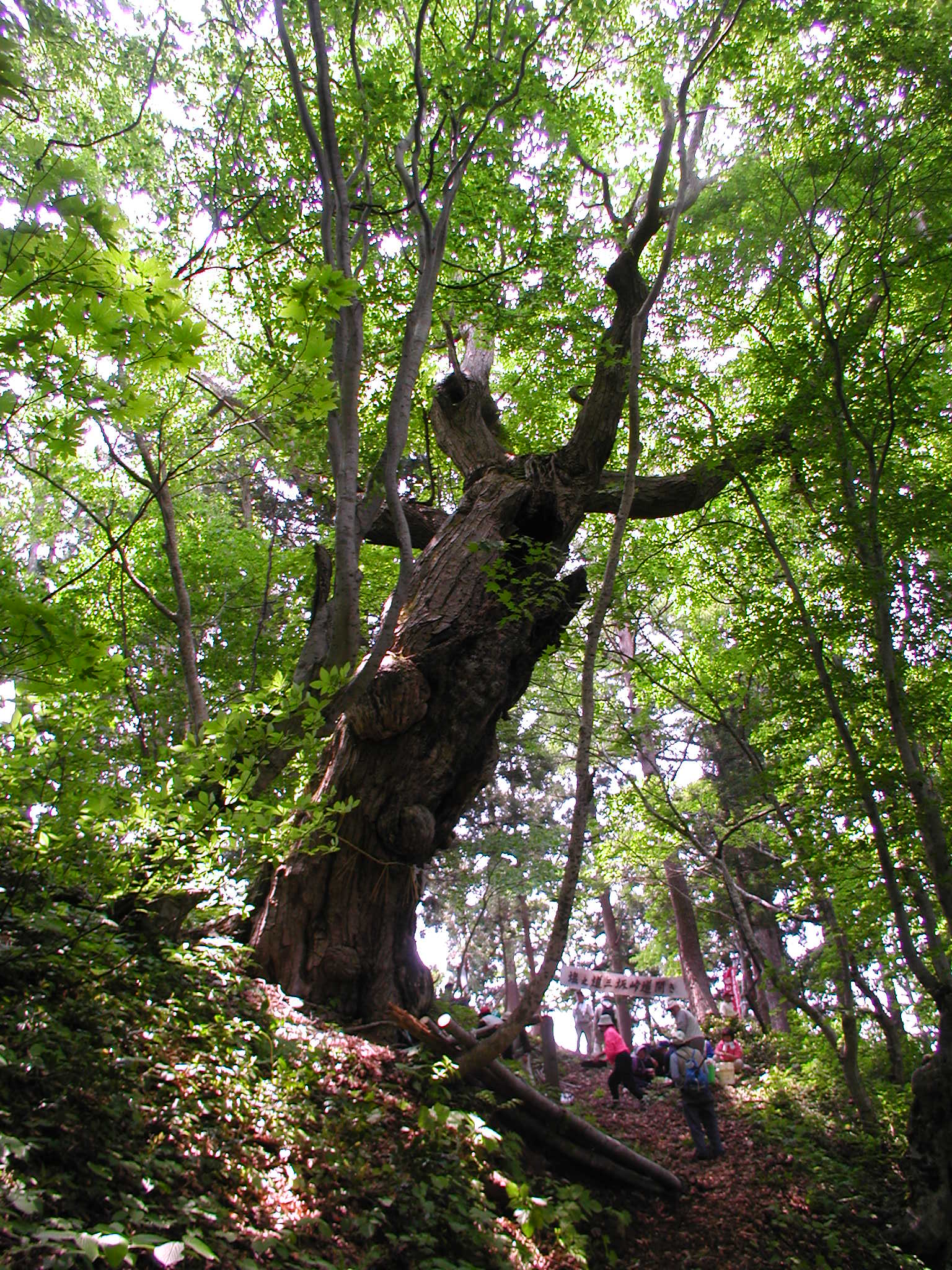
-
Misaka Toge
Misaka Pass, also known as O-toge, is the highest point along the entire Shionomichi, old or new, and stands at 1,215m of elevation. However, the usage of this pass is said to predate the Salt Road, and this area was likely being used as far back as thousands of years ago to trade Jade from the coast in Itoigawa with Obsidian from the volcanic Yatsugatake mountain range near Lake Suwa. From the northern side of the pass, one can enjoy panoramic views of the mountains along the Shin’etsu border, and the Sea of Japan.
-
Atosugi-zaka
It is believed the line of soldiers from Uesugi’s army sent to reinforce Hirakura Castle stretched over a staggering 2 kilometers, extending all the way from Ke-no-hira to here.
-
Tochi-no-kyoboku
This gigantic Japanese horse chestnut tree has a diameter of 6 meters.
-
Chojadaira
In the Warring States Period, this area was home to a large settlement of around 70 households populated by the same clan as Iimori Moriharu, but was burned down during a battle with Takeda Shingen’s forces.